Villages near Barberino Val d'Elsa: hidden Tuscany
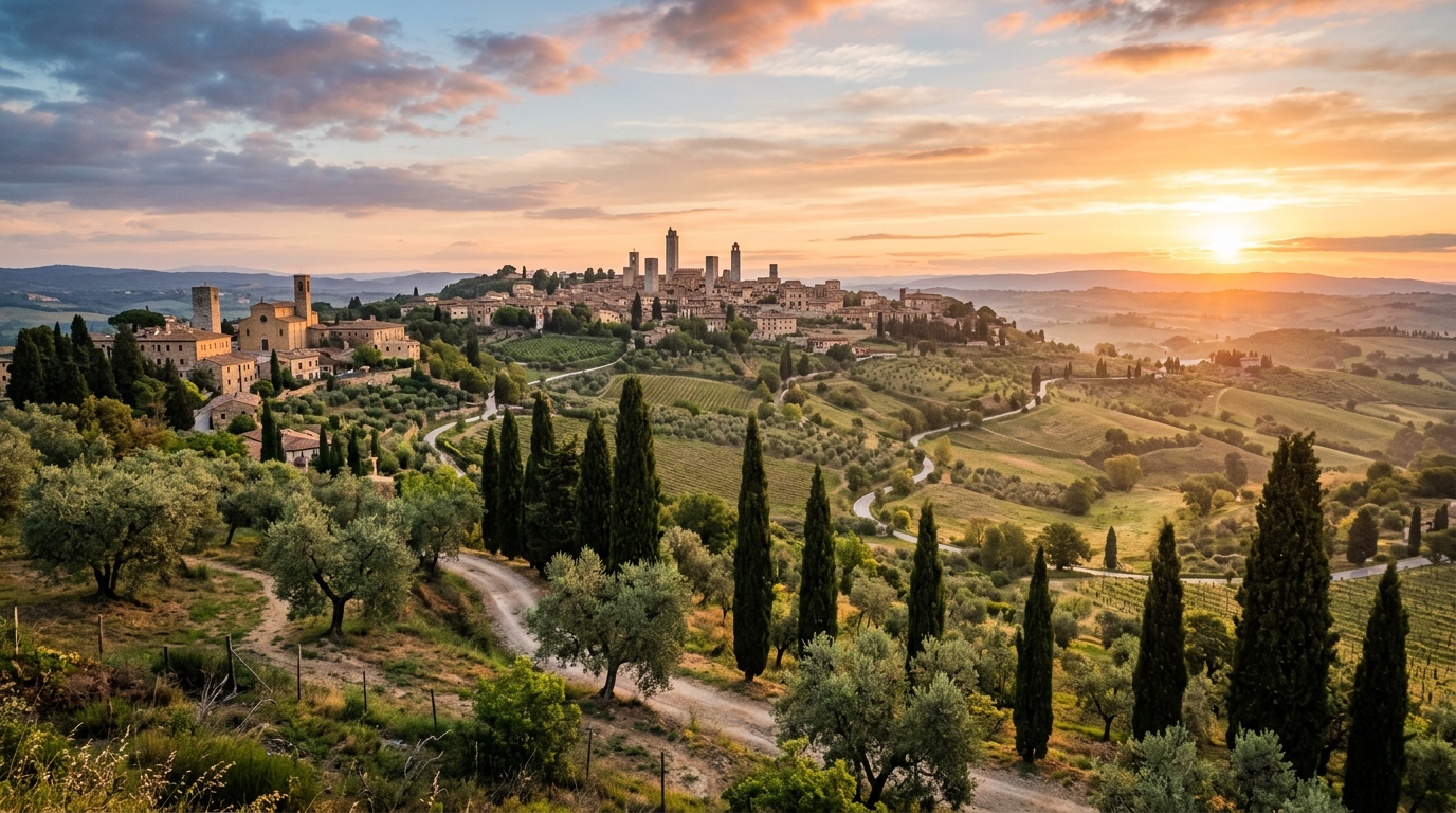
The countryside around Barberino Val d’Elsa is more layered than it first appears. From the valley road or the windows of a car on the SR2, it looks like open agricultural land — vineyards, wheat fields, olive groves, and occasional farmhouses rising against the sky. Look more carefully, and you begin to notice the ridges: every one of them occupied, or formerly occupied, by a cluster of buildings that once constituted a community.
Some of these communities are still active. Others have been reduced to a handful of houses, a church, and the memory of a larger past. Some no longer exist at all — deliberately destroyed, abandoned over centuries, or absorbed into the expanding farmlands below. Exploring the villages and former villages around Barberino is an exercise in reading landscape, and it produces the kind of discovery that guidebooks rarely describe because the things you find do not lend themselves to a neat list of sights.
Villages of Val d’Elsa around Barberino
Within a radius of 15 km from Barberino Val d’Elsa, the density of historic settlements is remarkable. Not all of them are intact, and not all are signposted. But together they form a detailed picture of how this territory was organised and inhabited over a period of a thousand years.
The landscape itself is the first thing to understand. The Val d’Elsa here is a mosaic of agricultural uses: Chianti Classico vineyards on the better-drained slopes, olive groves on the mid-level terraces, cereals and sunflowers on the flatter ground, and mixed woodland on the higher or steeper land. The hilltops, almost without exception, are occupied by human settlement — either active communities or the ruins and traces of former ones.
Connecting these settlements are the strade bianche, the unpaved white gravel roads that thread through the farmland below the ridges. These roads are the original agricultural communication network of this territory, and they survive because modern farming still uses them. They are also some of the most beautiful roads in Tuscany for cycling and walking, particularly in spring when the fields on either side are green and the air smells of cut grass and wildflowers.
Semifonte: the ghost village
Semifonte has one of the most dramatic histories of any settlement in the Val d’Elsa, and almost nothing visible to show for it. That combination — enormous historical significance and near-complete physical absence — is part of what makes it so striking.
In the 12th century, Semifonte was a flourishing commune on the hills above the Elsa river. Its commercial importance and growing population placed it in direct competition with Florence for control of the trade routes through the valley. Florence, unwilling to tolerate a rival capable of challenging its dominance of the region, destroyed Semifonte completely in 1202. The destruction was systematic and deliberate: buildings were levelled, and the Florentines prohibited any reconstruction of the site.
What followed was eight centuries of erasure. The building materials were gradually removed for use elsewhere. The agricultural land was redistributed. The very name Semifonte nearly disappeared from local memory.
What survives today is a single small chapel: the Oratorio di Semifonte, built in the 16th century as a memorial to the destroyed city. It stands alone in open farmland on the SP120 road between Barberino and Certaldo. The chapel is octagonal in plan, designed as a scaled-down replica of Florence’s Baptistery — a gesture of submission to the city that destroyed the original settlement, or perhaps an act of defiant commemoration. The interpretations differ.
Around the chapel, the ground is subtly uneven. Slight ridges and depressions in the earth mark the foundations and streets of the medieval city beneath the surface. No excavation has been carried out here on a large scale, which means the city still lies underground, largely undisturbed.
The chapel opens irregularly. Whether it is open or closed, the setting itself — a small domed building in an otherwise empty field, with the Val d’Elsa countryside stretching away on all sides — is sufficiently striking to justify the 15-minute drive from Barberino.
Marcialla and the farmhouses
Marcialla is a hamlet about 5 km south of Barberino Val d’Elsa on the SP12 road. It is the kind of place that barely registers on a tourist map: a few dozen stone houses, a Romanesque church, and the surrounding farmland. But it represents something genuine about this territory that larger, more visited places often obscure.
The Pieve di Marcialla dates from the 11th century. Romanesque churches of this period in the Val d’Elsa share common characteristics — simple stone facades, round-headed windows, modest proportions — but the Pieve di Marcialla has a particular quality of stillness. The building has not been heavily restored or decorated. It sits in its original relationship to the landscape, slightly raised above the hamlet, facing the valley. Inside, the space is bare and cool and genuinely old.
The land around Marcialla is densely settled with case coloniche — the large stone farmhouses that served as the operational centres of the mezzadria system. Under the mezzadria, which structured Tuscan agriculture from the medieval period until the 1960s, a farming family occupied a colonico and worked the surrounding land in exchange for half of the harvest. The system shaped the landscape: regular intervals of farmhouses, each surrounded by a defined parcel of mixed cultivation.
Many of these farmhouses have been converted into agriturismi or private residences. Others remain working farms. Their architectural character is consistent: two or three storeys, stone construction, a large ground-floor arch for equipment, and typically a loggia or external staircase on the main facade. The density of this architecture between Marcialla, Barberino, and San Donato in Poggio is exceptional — a kilometre rarely passes without a colonico appearing on one side of the road.
Routes between villages
The best way to explore this territory is on a combination of the SR2, the provincial roads, and the strade bianche that connect them. A car is the most flexible option for a first visit. Cyclists and walkers who know the area well prefer the smaller routes.
A loop of about 25 km starts in Barberino, goes north to Tavarnelle Val di Pesa, then east to Badia a Passignano — an 11th-century Vallombrosan abbey still active as a monastery and winery — and south through the Chianti vineyard country back to San Donato in Poggio and Barberino. This loop can be driven comfortably in an hour, or cycled at a relaxed pace in three to four hours.
A second loop runs south and west from Barberino: down to Marcialla, west to the Semifonte chapel, then north to Certaldo Alto and back along the SP1. This route is about 20 km by road and passes through the most historically significant part of the territory outside the main towns.
For a longer day, combine elements of both loops. Start early, include a winery stop in the late morning, take a picnic to eat near Semifonte, and finish with a walk through Certaldo Alto in the afternoon.
The strade bianche in this area are generally passable for gravel bikes and mountain bikes. In dry conditions, some sections work on road bikes. After sustained rainfall, the clay surface becomes slippery and slow. Check conditions before setting off on an unpaved route.
How to plan an itinerary
A well-paced day exploring the villages around Barberino might work as follows.
Start the morning in Barberino Val d’Elsa itself — a walk through the medieval centre, along the walls and past the Palazzo Pretorio, takes about 45 minutes and gives you a point of orientation for the surrounding territory.
Drive south to San Donato in Poggio, about 5 km. Walk the medieval hamlet for 20 minutes and stop at the local enoteca for a glass of Chianti Classico and a look at which producers are stocking bottles currently. San Donato in Poggio’s enoteca is one of the best informal wine stops in the entire Val d’Elsa area.
Lunch at a trattoria in San Donato or as a picnic assembled from the enoteca and a local alimentari. The countryside near Semifonte is a good picnic setting.
After lunch, drive to the Semifonte chapel and spend 20 minutes walking around the site. Then continue south-west to Marcialla to see the Pieve. Allow an hour for this section of the day.
Late afternoon: return to Barberino via the SP120 and SP12, or extend the day by driving east to Badia a Passignano. The monastery courtyard is a good place for an aperitivo in the late afternoon.
Bring a paper map or download an offline map for this area before you set out. Mobile coverage on the smaller roads is inconsistent.
Where to stay
Sogno d’Oro is located near Barberino Val d’Elsa, in the Val d’Elsa countryside at the centre of the territory described in this guide. Semifonte is about 10 minutes away by car, San Donato in Poggio is about 8 minutes, and Marcialla is about 12 minutes. The network of strade bianche and provincial roads connecting these villages begins at the end of the guesthouse’s own driveway.
From here, the entire circuit of villages described above is your immediate neighbourhood.